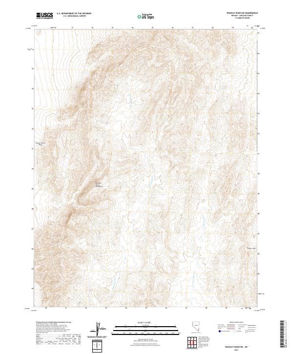
2021 Map of Wildcat Wash NE
USGS Topo · Published 2021About this map
The Meadow Valley Mountains dominate this high-desert landscape in Lincoln County, where the topography is defined by intricate drainage patterns and significant elevation changes. The eastern slopes descend into the Bunker Hills, while the western edge of the sheet touches the broad expanse of Coyote Spring Valley. This modern survey by the U.S. Geological Survey details the seasonal watercourses that shape the terrain, most notably the central Wildcat Wash and the southeastern Farrier Wash. The land is predominantly organized through the Public Land Survey System, with numerous township and range lines like t11s r64e marking the arid basins. It is a territory defined by its natural barriers and the rare, ephemeral tracks of water moving through the Great Basin.
Find a feature on this map
12 named features on this map. Tap any name to fly to it.
Don’t see what you’re looking for? This feature index may not catch every label — zoom into the map to look around manually.
Map Details
Editions of this 2021 Wildcat Wash NE Map
This is the sole edition of this map. No revisions or reprints were ever made.
Other maps of this area

1885 · Pioche
USGS Topo · 1:250,000

1886 · Saint Thomas
USGS Topo · 1:250,000

1886 · Pioche
USGS Topo · 1:250,000

1893 · Saint Thomas
USGS Topo · 1:250,000

1954 · Caliente
USGS Topo · 1:250,000

1954 · Las Vegas
USGS Topo · 1:250,000

1957 · Las Vegas
USGS Topo · 1:250,000

1959 · Caliente
USGS Topo · 1:250,000

1959 · Las Vegas
USGS Topo · 1:250,000

1962 · Las Vegas
USGS Topo · 1:250,000