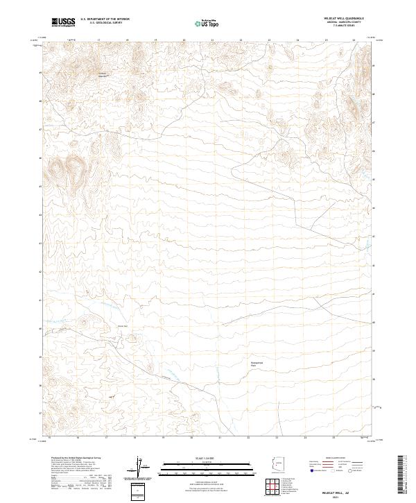
2021 Map of Wildcat Well
USGS Topo · Published 2021About this map
The Vulture Mountains dominate the northern terrain of this Maricopa County landscape, where the arid high desert transitions into the open expanse of the Hassayampa Plain. This modern survey documents the sparse but vital water infrastructure of the region, anchored by the namesake Wildcat Well. A network of seasonal drainages, including Jackrabbit Wash, Dead Horse Wash, and Tank Wash, defines the natural flow of the land toward the south. The presence of Aguila Rd and N Aguila Rd indicates the primary corridors of travel through this remote stretch of Arizona. The map provides a precise look at the township and range divisions, such as t6n r7w and t5n r6w, which organize the rugged topography for land management and contemporary resource tracking.
Find a feature on this map
14 named features on this map. Tap any name to fly to it.
Don’t see what you’re looking for? This feature index may not catch every label — zoom into the map to look around manually.
Map Details
Editions of this 2021 Wildcat Well Map
This is the sole edition of this map. No revisions or reprints were ever made.
Other maps of this area

1942 · Vicksburg
USGS Topo · 1:250,000

1954 · Phoenix
USGS Topo · 1:250,000

1957 · Phoenix
USGS Topo · 1:250,000

1958 · Phoenix
USGS Topo · 1:250,000

1960 · Phoenix
USGS Topo · 1:250,000

1961 · Vulture Mountains
USGS Topo · 1:62,500

1961 · Big Horn Mts
USGS Topo · 1:62,500

1962 · Belmont Mts
USGS Topo · 1:62,500
1962 · Aguila
USGS Topo · 1:62,500

1969 · Phoenix
USGS Topo · 1:250,000