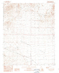
1990 Map of Wildcat Well
USGS Topo · Published 1990About this map
Vulture Mountains dominate the northern landscape of this Maricopa County region, giving way to the broad expanse of the Hassayampa Plain to the south. This desert environment is defined by its drainage systems and ephemeral water sources, with Dead Horse Wash and Jackrabbit Wash carving paths through the arid terrain. Human activity in the late 20th century is evidenced by a network of resource extraction and ranching infrastructure, ranging from a Mine Shaft and numerous scattered Prospects in the uplands to the namesake Wildcat Well and various Corral sites. Infrastructure like the Powerline and Trans Lines cut across the flats, while more primitive routes like the Pack Trail suggest the area's continued use for traditional transit and ranching through the 1980s. Vital water points for livestock or wildlife are meticulously noted, including the Rock Holes Tank, Guzzler, and several other tanks.
Find a feature on this map
20 named features on this map. Tap any name to fly to it.
Don’t see what you’re looking for? This feature index may not catch every label — zoom into the map to look around manually.
Map Details
Editions of this 1990 Wildcat Well Map
This is the sole edition of this map. No revisions or reprints were ever made.
Other maps of this area

1942 · Vicksburg
USGS Topo · 1:250,000

1954 · Phoenix
USGS Topo · 1:250,000

1957 · Phoenix
USGS Topo · 1:250,000

1958 · Phoenix
USGS Topo · 1:250,000

1960 · Phoenix
USGS Topo · 1:250,000

1961 · Vulture Mountains
USGS Topo · 1:62,500

1961 · Big Horn Mts
USGS Topo · 1:62,500

1962 · Belmont Mts
USGS Topo · 1:62,500
1962 · Aguila
USGS Topo · 1:62,500

1969 · Phoenix
USGS Topo · 1:250,000