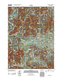
2011 Map of Wilderville
USGS Topo · Published 2011About this map
The confluence of the Rogue River and the Applegate River defines this landscape in Josephine County. This 2011 survey illustrates a region where water management is central to the land use, evidenced by a dense network of reservoirs and ponds including Aqua Fria Reservoir, Steppe Reservoir, and Apple Rogue Reservoir. The map documents the persistent rural infrastructure of the area, centered on Wilderville and the residential expansion near Redwood. For those researching local history, the placement of the Wilderville Post Office and the survival of distinct burial grounds like Wilderville Cemetery, Sloan Cemetery, and Ferrydale Cemetery provide essential genealogical markers. Notable geographic features such as The Canyon and Finley Bend characterize the river's winding path, while the presence of Baum Slough and Slate Creek indicates the complex drainage patterns that supported early settlement and agriculture.
Find a feature on this map
140 named features on this map. Tap any name to fly to it.
Don’t see what you’re looking for? This feature index may not catch every label — zoom into the map to look around manually.
Map Details
Editions of this 2011 Wilderville Map
This is the sole edition of this map. No revisions or reprints were ever made.
Other maps of this area

1904 · Riddle
USGS Topo · 1:125,000

1908 · Grants Pass
USGS Topo · 1:125,000

1917 · Kerby
USGS Topo · 1:125,000

1918 · Kerby
USGS Topo · 1:125,000

1945 · Kerby
USGS Topo · 1:125,000

1946 · Galice
USGS Topo · 1:62,500

1948 · Galice
USGS Topo · 1:62,500

1954 · Glendale
USGS Topo · 1:62,500

1954 · Selma
USGS Topo · 1:62,500

1954 · Grants Pass
USGS Topo · 1:62,500