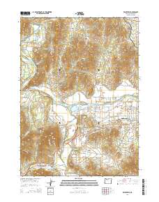
2014 Map of Wilderville
USGS Topo · Published 2014About this map
The Rogue River and Applegate River dominate this landscape west of Grants Pass, carving through a region defined by agricultural plains and timbered gulches. The settlement of Wilderville serves as a local hub near the southern edge, situated where the Redwood Hwy meets historic routes like Old Highway 199. The mapping of irrigation infrastructure, such as the Jerome Prairie Lateral and Baum Slough, illustrates the transformation of the arid valley floor into the productive grounds of Jerome Prairie.
Find a feature on this map
56 named features on this map. Tap any name to fly to it.
Don’t see what you’re looking for? This feature index may not catch every label — zoom into the map to look around manually.
Map Details
Editions of this 2014 Wilderville Map
This is the sole edition of this map. No revisions or reprints were ever made.
Other maps of this area

1904 · Riddle
USGS Topo · 1:125,000

1908 · Grants Pass
USGS Topo · 1:125,000

1917 · Kerby
USGS Topo · 1:125,000

1918 · Kerby
USGS Topo · 1:125,000

1945 · Kerby
USGS Topo · 1:125,000

1946 · Galice
USGS Topo · 1:62,500

1948 · Galice
USGS Topo · 1:62,500

1954 · Glendale
USGS Topo · 1:62,500

1954 · Selma
USGS Topo · 1:62,500

1954 · Grants Pass
USGS Topo · 1:62,500