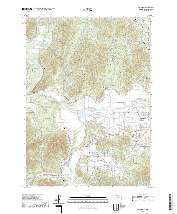
2023 Map of Wilderville
USGS Topo · Published 2023About this map
The Rogue Wild and Scenic River and Applegate River dominate this Josephine County landscape, converging near a network of rural settlements and agricultural land. The confluence of these waterways shaped the development of communities like Wilderville and Merlin, which are linked by historic transit corridors such as Riverbanks Rd and Lower River Rd. Genealogists will find significant value in the documentation of local burial sites, including Wilderville Cem, Ferrydale Cem, and Sloan Cem, which anchor family histories in the region. The landscape transitions from the river valleys toward elevations like Sloan Mtn and the passage at Stringer Gap, while the eastern portion of the map shows the suburban expansion of Redwood and the western edge of Grants Pass, including the campus of Rogue Community College.
Find a feature on this map
154 named features on this map. Tap any name to fly to it.
Don’t see what you’re looking for? This feature index may not catch every label — zoom into the map to look around manually.
Map Details
Editions of this 2023 Wilderville Map
This is the sole edition of this map. No revisions or reprints were ever made.
Other maps of this area

1904 · Riddle
USGS Topo · 1:125,000

1908 · Grants Pass
USGS Topo · 1:125,000

1917 · Kerby
USGS Topo · 1:125,000

1918 · Kerby
USGS Topo · 1:125,000

1945 · Kerby
USGS Topo · 1:125,000

1946 · Galice
USGS Topo · 1:62,500

1948 · Galice
USGS Topo · 1:62,500

1954 · Glendale
USGS Topo · 1:62,500

1954 · Selma
USGS Topo · 1:62,500

1954 · Grants Pass
USGS Topo · 1:62,500