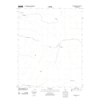
2012 Map of Wildrose Peak
USGS Topo · Published 2012About this map
Harrisburg sits near the northwest edge of this high-altitude landscape, overlooking the wide expanse of Harrisburg Flats. This portion of Death Valley National Park is defined by sharp elevation shifts and deep drainage systems, dominated by the massif of Wildrose Peak and the nearby Bald Peak. The topography is etched by ancient watercourses, including the Wet Fork Blackwater Wash and several prominent canyons such as Wood Canyon and Death Valley Canyon. Access through this desert terrain is provided by a network of unimproved routes, including Wood Canyon Rd and Trail Canyon Rd, which follow the natural contours of the land toward Aguereberry Point. The map illustrates a stark, arid environment where human infrastructure is limited to these essential corridor roads and small settlements situated at the mouths of major washes.
Find a feature on this map
15 named features on this map. Tap any name to fly to it.
Don’t see what you’re looking for? This feature index may not catch every label — zoom into the map to look around manually.
Map Details
Editions of this 2012 Wildrose Peak Map
This is the sole edition of this map. No revisions or reprints were ever made.
Other maps of this area

1908 · Furnace Creek
USGS Topo · 1:250,000

1908 · Ballarat
USGS Topo · 1:250,000

1910 · Furnace Creek
USGS Topo · 1:250,000

1913 · Ballarat
USGS Topo · 1:250,000

1948 · Death Valley
USGS Topo · 1:250,000

1952 · Furnace Creek
USGS Topo · 1:62,500

1952 · Bennetts Well
USGS Topo · 1:62,500

1952 · Telescope Peak
USGS Topo · 1:62,500

1952 · Emigrant Canyon
USGS Topo · 1:62,500

1954 · Death Valley
USGS Topo · 1:250,000