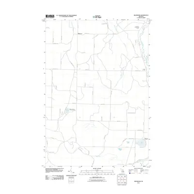
2011 Map of Wildwood
USGS Topo · Published 2011About this map
The Sturgeon River winds through the northeast corner of this Michigan landscape, providing a natural anchor for the surrounding woodlands and small lakeside clearings. The area is defined by its recreation and memorial sites, notably the Indian River Catholic Shrine Cemetery and the Weber Lake State Forest Campground. A network of local roads such as Wildwood Rd and Watson Rd connects isolated homesteads and several small water bodies including Silver Lake and Fulmer Lake. The terrain is drained by numerous small streams like Cedar Creek and Berry Creek, reflecting the typical glacial geography of the region. The map preserves the names of early local routes and landholdings, such as Boyer Hill Rd and Morton Rd, which are of particular value to those researching family roots or the evolution of the road network in Chandler Township.
Find a feature on this map
66 named features on this map. Tap any name to fly to it.
Don’t see what you’re looking for? This feature index may not catch every label — zoom into the map to look around manually.
Map Details
Editions of this 2011 Wildwood Map
This is the sole edition of this map. No revisions or reprints were ever made.
Other maps of this area

1954 · Gaylord
USGS Topo · 1:62,500

1955 · Cheboygan
USGS Topo · 1:250,000

1957 · Wolverine
USGS Topo · 1:62,500

1958 · Cheboygan
USGS Topo · 1:250,000

1958 · Petoskey
USGS Topo · 1:62,500

1961 · Boyne Falls
USGS Topo · 1:62,500

1975 · Petoskey NE
USGS Topo · 1:24,000

1982 · Petoskey
USGS Topo · 1:100,000
1983 · Alanson
USGS Topo · 1:24,000
1983 · Epsilon
USGS Topo · 1:25,000