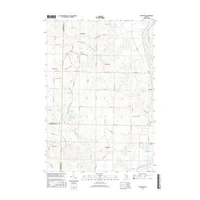
2017 Map of Wildwood
USGS Topo · Published 2017About this map
Wildwood and the rural lands of northern Michigan are documented here at the convergence of Emmet, Cheboygan, and Charlevoix counties. The landscape is defined by an intricate network of non-motorized routes, including the Wildwood Hills Pathway, the Lost Tamarack Pathway, and the N Central State Trail, which traces a former railroad corridor through the eastern half of the map. These trails navigate a terrain of small glacial lakes and streams, most notably Weber Lake and the Sturgeon River.
Find a feature on this map
66 named features on this map. Tap any name to fly to it.
Don’t see what you’re looking for? This feature index may not catch every label — zoom into the map to look around manually.
Map Details
Editions of this 2017 Wildwood Map
This is the sole edition of this map. No revisions or reprints were ever made.
Other maps of this area

1954 · Gaylord
USGS Topo · 1:62,500

1955 · Cheboygan
USGS Topo · 1:250,000

1957 · Wolverine
USGS Topo · 1:62,500

1958 · Cheboygan
USGS Topo · 1:250,000

1958 · Petoskey
USGS Topo · 1:62,500

1961 · Boyne Falls
USGS Topo · 1:62,500

1975 · Petoskey NE
USGS Topo · 1:24,000

1982 · Petoskey
USGS Topo · 1:100,000
1983 · Alanson
USGS Topo · 1:24,000
1983 · Epsilon
USGS Topo · 1:25,000