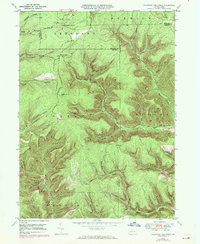
1948 Map of Wildwood Fire Tower
USGS Topo · Published 1972About this map
The Wildwood Fire Tower stands as a central landmark over a heavily dissected landscape where the borders of Elk, McKean, and Cameron counties converge. Photorevised in the early 1970s from 1940s data, this map captures a remote section of the Pennsylvania wilds defined by a dense network of watercourses and deep hollows. The small settlement of Wellendorf Station in the north suggests the area's historical reliance on the rail-and-timber industry, situated near the headwaters of the Wellendorf Branch.
Find a feature on this map
41 named features on this map. Tap any name to fly to it.
Don’t see what you’re looking for? This feature index may not catch every label — zoom into the map to look around manually.
Map Details
Editions of this 1948 Wildwood Fire Tower Map
5 editions found
Other maps of this area

1935 · Mt. Jewett
USGS Topo · 1:48,000

1940 · Mt. Jewett
USGS Topo · 1:62,500

1941 · Benezette
USGS Topo · 1:62,500

1941 · Ridgway
USGS Topo · 1:62,500

1943 · Benezette
USGS Topo · 1:62,500

1944 · Ridgway
USGS Topo · 1:62,500

1948 · Crosby
USGS Topo · 1:62,500

1948 · Wildwood Fire Tower
USGS Topo · 1:24,000

1948 · Rich Valley
USGS Topo · 1:24,000

1948 · Norwich
USGS Topo · 1:24,000