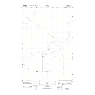
2010 Map of Wildwood
USGS Topo · Published 2010About this map
Wildwood is a small settlement in the northern Minnesota woods, situated along a network of rural routes that include County Hwy-27 and County Hwy-54. The landscape is characterized by the winding paths of Dinner Creek and Caldwell Brook, which snake through the territory and intersect with local thoroughfares like Gemmell Rd. This 2010 survey shows a quiet region where the infrastructure is largely composed of unpaved and county roads, reflecting a remote lifestyle centered on the natural environment. Genealogists and local historians will find the Wildwood Cemetery near the junction of Wildwood Rd and County Hwy-54, a primary landmark for the community. Other secondary routes like Smallfox Rd and Town Road 17 define the small-scale grid of this woodland area.
Find a feature on this map
11 named features on this map. Tap any name to fly to it.
Don’t see what you’re looking for? This feature index may not catch every label — zoom into the map to look around manually.
Map Details
Editions of this 2010 Wildwood Map
This is the sole edition of this map. No revisions or reprints were ever made.
Other maps of this area

1918 · Zora
USGS Topo · 1:62,500

1919 · Zora
USGS Topo · 1:62,500

1919 · Lundgren
USGS Topo · 1:62,500

1919 · Gemmell
USGS Topo · 1:62,500

1919 · Margie
USGS Topo · 1:62,500

1954 · Bemidji
USGS Topo · 1:250,000

1954 · Hibbing
USGS Topo · 1:250,000

1954 · Roseau
USGS Topo · 1:250,000

1954 · International Falls
USGS Topo · 1:250,000

1957 · Roseau
USGS Topo · 1:250,000