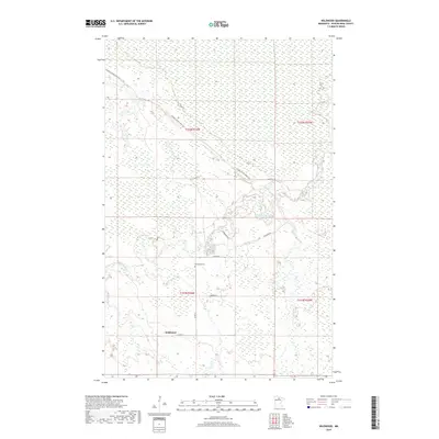
2019 Map of Wildwood
USGS Topo · Published 2019About this map
Wildwood stands as the primary point of settlement in this northern Minnesota landscape, surrounded by an extensive network of wetlands and forested ridges. The geography is defined by subtle elevation changes traced by Gemmell Ridge Forest Rd, which cuts diagonally across the township lines. Local history is anchored at the Wildwood Cem, situated near the junction of Co Rd 27 and Wildwood Rd. The drainage of this often-saturated terrain is managed by Caldwell Brook, which meanders through the central sections of the quadrangle. The naming of Smallpox Rd in the eastern portion of the survey hints at the local legacy of historical disease outbreaks or quarantine sites in this remote area of Koochiching County. This map reflects a landscape where human habitation is sparse and carefully positioned relative to the water-heavy terrain.
Find a feature on this map
14 named features on this map. Tap any name to fly to it.
Don’t see what you’re looking for? This feature index may not catch every label — zoom into the map to look around manually.
Map Details
Editions of this 2019 Wildwood Map
This is the sole edition of this map. No revisions or reprints were ever made.
Other maps of this area

1918 · Zora
USGS Topo · 1:62,500

1919 · Zora
USGS Topo · 1:62,500

1919 · Lundgren
USGS Topo · 1:62,500

1919 · Gemmell
USGS Topo · 1:62,500

1919 · Margie
USGS Topo · 1:62,500

1954 · Bemidji
USGS Topo · 1:250,000

1954 · Hibbing
USGS Topo · 1:250,000

1954 · Roseau
USGS Topo · 1:250,000

1954 · International Falls
USGS Topo · 1:250,000

1957 · Roseau
USGS Topo · 1:250,000