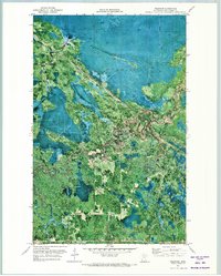
1971 Map of Wildwood
USGS Topo · Published 1973About this map
Pine Island State Forest dominates this landscape in northern Minnesota, where the terrain is defined by its seasonal accessibility. The orthophotomap imagery highlights a complex network of wetlands and wooded sections, where transportation is specifically categorized into a Summer Road and a Winter Trail. This distinction provides a clear insight into the timber and land management practices of the early 1970s, where certain routes were likely only navigable when the ground was frozen. Small pockets of human activity are evident at the settlement of Wildwood, the local Townhall, and the landmark of Caldwell. This survey preserves the exact footprint of these remote outposts and their relationship to the primary industrial features of the area, including a Gravel Pit and various unnamed Trails weaving through the dense forest cover.
Find a feature on this map
9 named features on this map. Tap any name to fly to it.
Don’t see what you’re looking for? This feature index may not catch every label — zoom into the map to look around manually.
Map Details
Editions of this 1971 Wildwood Map
This is the sole edition of this map. No revisions or reprints were ever made.
Other maps of this area

1918 · Zora
USGS Topo · 1:62,500

1919 · Zora
USGS Topo · 1:62,500

1919 · Lundgren
USGS Topo · 1:62,500

1919 · Gemmell
USGS Topo · 1:62,500

1919 · Margie
USGS Topo · 1:62,500

1954 · Bemidji
USGS Topo · 1:250,000

1954 · Hibbing
USGS Topo · 1:250,000

1954 · Roseau
USGS Topo · 1:250,000

1954 · International Falls
USGS Topo · 1:250,000

1957 · Roseau
USGS Topo · 1:250,000