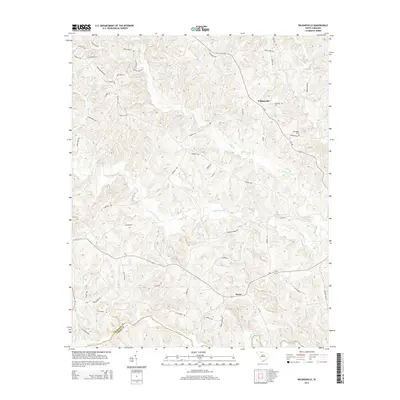
2014 Map of Wilkinsville
USGS Topo · Published 2014About this map
The Pacolet River defines the southern reach of this landscape, carving a wide valley along the boundary between Cherokee Co and Union Co. The terrain is defined by a dense network of tributaries including Thicketty Creek, Gilkey Cr, and Abingdon Cr, which create a series of ridges and hollows that have historically shaped local movement. Small settlements such as Wilkinsville and Saratt serve as quiet hubs within a road network that reflects deep-rooted family landholdings, seen in names like Wilkins Farm Rd, Morris Farm Rd, and Roy's Farm Rd. A sense of local history is preserved at the Abingdon Cem and along Covered Bridge Rd, while the name Justis Mill Cr points to the early water-powered industry that once supported this rural Piedmont community.
Find a feature on this map
56 named features on this map. Tap any name to fly to it.
Don’t see what you’re looking for? This feature index may not catch every label — zoom into the map to look around manually.
Map Details
Editions of this 2014 Wilkinsville Map
This is the sole edition of this map. No revisions or reprints were ever made.
Other maps of this area

1906 · Kings Mountain
USGS Topo · 1:62,500

1907 · Sharon
USGS Topo · 1:62,500

1908 · Kings Mountain
USGS Topo · 1:62,500

1909 · Gaffney
USGS Topo · 1:62,500

1941 · Spartanburg
USGS Topo · 1:250,000

1953 · Spartanburg
USGS Topo · 1:250,000

1953 · Charlotte
USGS Topo · 1:250,000

1954 · Charlotte
USGS Topo · 1:250,000

1960 · Charlotte
USGS Topo · 1:250,000

1960 · Spartanburg
USGS Topo · 1:250,000