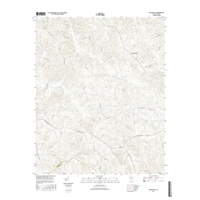
2017 Map of Wilkinsville
USGS Topo · Published 2017About this map
Wilkinsville and Saratt anchor this upland landscape near the boundary of Cherokee Co and Union Co in South Carolina. The terrain is defined by a dense network of watercourses, with Thicketty Creek winding through the center and the Pacolet River forming a natural border to the south. Local transit history is evidenced by descriptive routes such as Billy Goat Bridge Rd and Covered Bridge Rd, reflecting a past era of creek crossings. The map reveals a land long shaped by agriculture and local families, seen in the numerous homestead-named thoroughfares like Wilkins Farm Rd and Thompson Farm Rd. For genealogists, the Abingdon Cem near Abingdon Cr provides a specific point of interest for tracing early area residents. The drainage patterns of Gilkey Cr and Lusts Mill Cr suggest a landscape once tied closely to the water-powered industry of the region.
Find a feature on this map
61 named features on this map. Tap any name to fly to it.
Don’t see what you’re looking for? This feature index may not catch every label — zoom into the map to look around manually.
Map Details
Editions of this 2017 Wilkinsville Map
This is the sole edition of this map. No revisions or reprints were ever made.
Other maps of this area

1906 · Kings Mountain
USGS Topo · 1:62,500

1907 · Sharon
USGS Topo · 1:62,500

1908 · Kings Mountain
USGS Topo · 1:62,500

1909 · Gaffney
USGS Topo · 1:62,500

1941 · Spartanburg
USGS Topo · 1:250,000

1953 · Spartanburg
USGS Topo · 1:250,000

1953 · Charlotte
USGS Topo · 1:250,000

1954 · Charlotte
USGS Topo · 1:250,000

1960 · Charlotte
USGS Topo · 1:250,000

1960 · Spartanburg
USGS Topo · 1:250,000