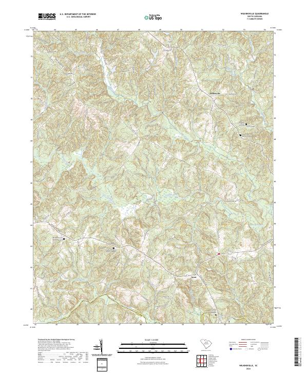
2024 Map of Wilkinsville
USGS Topo · Published 2024About this map
The Pacolet River defines the southern boundary of this Piedmont landscape, where the border between Cherokee and Union counties follows the river's winding course. This area is characterized by a dense network of small rural settlements and religious centers, notably the hamlet of Wilkinsville and the community of Saratt. The map provides significant detail for genealogists, documenting several distinct burial grounds including the Abingdon and Mount Tabor graveyards in the north, and the Skull Shoals Baptist Graveyard near the river.
Find a feature on this map
73 named features on this map. Tap any name to fly to it.
Don’t see what you’re looking for? This feature index may not catch every label — zoom into the map to look around manually.
Map Details
Editions of this 2024 Wilkinsville Map
This is the sole edition of this map. No revisions or reprints were ever made.
Other maps of this area

1906 · Kings Mountain
USGS Topo · 1:62,500

1907 · Sharon
USGS Topo · 1:62,500

1908 · Kings Mountain
USGS Topo · 1:62,500

1909 · Gaffney
USGS Topo · 1:62,500

1941 · Spartanburg
USGS Topo · 1:250,000

1953 · Spartanburg
USGS Topo · 1:250,000

1953 · Charlotte
USGS Topo · 1:250,000

1954 · Charlotte
USGS Topo · 1:250,000

1960 · Charlotte
USGS Topo · 1:250,000

1960 · Spartanburg
USGS Topo · 1:250,000