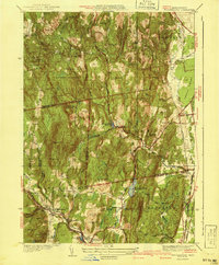
1941 Map of Williamsburg
USGS Topo · Published 1941About this map
The hills of Franklin and Hampshire counties define this 1941 edition, where the industrial legacy of the Pioneer Valley meets the rugged terrain of the eastern Berkshires. Along the southern edge, the New York and New Haven and Hartford RR terminates at the Williamsburg Sta, marking the end of a line that fueled local manufacturing in Williamsburg and Haydenville. The map captures the complex water management of the era, from the industrial Brass Mill Pond to the civic utility of the Northampton Reservoir and Mountain Street Reservoir. To the north, the landscape transitions into the wooded tracts of Conway State Forest and the peculiar topography of Joe Herrick Gulf. Small rural crossroads like West Whately and Poland Gate persist among named family landmarks like Davis Hill and O'Neil Hill, reflecting a pre-war settlement pattern before modern suburbanization altered these hilltop hamlets.
Find a feature on this map
68 named features on this map. Tap any name to fly to it.
Don’t see what you’re looking for? This feature index may not catch every label — zoom into the map to look around manually.
Map Details
Editions of this 1941 Williamsburg Map
3 editions found
Other maps of this area

1885 · Northampton
USGS Topo · 1:62,500

1886 · Hawley
USGS Topo · 1:62,500

1886 · Chesterfield
USGS Topo · 1:62,500

1886 · Northampton
USGS Topo · 1:62,500

1888 · Chesterfield
USGS Topo · 1:62,500

1890 · Hawley
USGS Topo · 1:62,500

1890 · Greenfield
USGS Topo · 1:62,500

1891 · Northampton
USGS Topo · 1:62,500

1893 · Northampton
USGS Topo · 1:62,500

1893 · Chesterfield
USGS Topo · 1:62,500