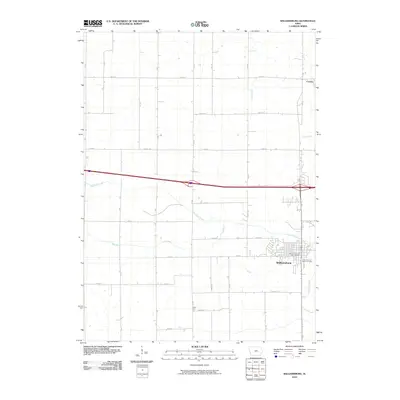
2010 Map of Williamsburg
USGS Topo · Published 2010About this map
Williamsburg serves as the primary hub of this Iowa County landscape, its grid-like residential streets and downtown area clustered around the Williamsburg Post Office. The surrounding rural territory is defined by a rigorous section-line road network, including thoroughfares such as Co HWY f35 and 220th St, which facilitate movement between smaller outlying points like Conroy to the northeast and the settlement of West Troy to the south. The natural drainage of the region is characterized by the winding paths of Old Mans Creek and Hog Run, which cut across the geometric precision of the farm plots. These waterways, along with Hilton Creek and Clear Creek, provide the only breaks in an otherwise orderly agricultural system, while the Williamsburg Sport Complex indicates the modern community expansion on the edge of town.
Find a feature on this map
36 named features on this map. Tap any name to fly to it.
Don’t see what you’re looking for? This feature index may not catch every label — zoom into the map to look around manually.
Map Details
Editions of this 2010 Williamsburg Map
This is the sole edition of this map. No revisions or reprints were ever made.
Other maps of this area

1888 · Amana
USGS Topo · 1:62,500

1889 · Amana
USGS Topo · 1:62,500

1891 · Oxford
USGS Topo · 1:62,500

1894 · Oxford
USGS Topo · 1:62,500

1899 · Amana
USGS Topo · 1:62,500

1903 · Fairfax
USGS Topo · 1:125,000

1954 · Des Moines
USGS Topo · 1:250,000

1956 · Des Moines
USGS Topo · 1:250,000

1957 · Des Moines
USGS Topo · 1:250,000

1958 · Davenport
USGS Topo · 1:250,000