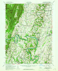
1944 Map of Williamsport
USGS Topo · Published 1965About this map
The Potomac River defines the landscape of this 1940s-era survey, its dramatic bends like Millers Bend and Whitings Neck creating a complex border between Maryland and West Virginia. Following the river's winding northern bank, the Chesapeake and Ohio Canal is a prominent industrial feature, passing through notable points such as Two Locks and Four Locks near Fort Frederick State Park. This period of Maryland history shows a transition from earlier rural industries, evidenced by the Green Spring Furnace and Cushwa Mill, toward modern infrastructure like the Williamsport Power Plant.
Find a feature on this map
135 named features on this map. Tap any name to fly to it.
Don’t see what you’re looking for? This feature index may not catch every label — zoom into the map to look around manually.
Map Details
Editions of this 1944 Williamsport Map
2 editions found
Other maps of this area

1884 · Harpers Ferry
USGS Topo · 1:125,000

1891 · Harpers Ferry
USGS Topo · 1:125,000

1893 · Harpers Ferry
USGS Topo · 1:125,000

1894 · Winchester
USGS Topo · 1:125,000

1899 · Hancock
USGS Topo · 1:62,500

1900 · Mercersburg
USGS Topo · 1:62,500

1901 · Hancock
USGS Topo · 1:62,500

1902 · Chambersburg
USGS Topo · 1:62,500

1902 · Mercersburg
USGS Topo · 1:62,500

1908 · Middletown
USGS Topo · 1:48,000