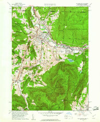
1960 Map of Williamstown
USGS Topo · Published 1961About this map
Williams College serves as the academic heart of Williamstown, surrounded by a landscape of prominent peaks and historic estates. To the south, the massive profile of Mt Greylock dominates the horizon, crowned by the War Memorial Beacon within the Mt Greylock State Reservation. The terrain is deeply carved by the Hoosic River and its many tributaries, such as Hemlock Brook and Green River.
Find a feature on this map
80 named features on this map. Tap any name to fly to it.
Don’t see what you’re looking for? This feature index may not catch every label — zoom into the map to look around manually.
Map Details
Editions of this 1960 Williamstown Map
2 editions found
Other maps of this area

1886 · Greylock
USGS Topo · 1:62,500

1888 · Berlin
USGS Topo · 1:62,500

1890 · Berlin
USGS Topo · 1:62,500

1891 · Greylock
USGS Topo · 1:62,500

1893 · Greylock
USGS Topo · 1:62,500

1894 · Berlin
USGS Topo · 1:62,500

1897 · Hoosick
USGS Topo · 1:62,500

1898 · Berlin
USGS Topo · 1:62,500

1898 · Bennington
USGS Topo · 1:62,500

1898 · Greylock
USGS Topo · 1:62,500