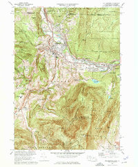
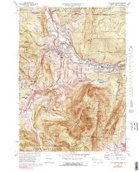
1973 Map of Williamstown
USGS Topo · Published 1975About this map
Williams College anchors the heart of this Berkshire County landscape, where the academic grounds of Williamstown meet the steep slopes of the Taconic and Hoosac ranges. The 1973 survey captures the area's intricate balance of institutional life and preserved wilderness, from the historic College Cem to the sprawling Hopkins Memorial Forest. The northern reach is defined by the Hoosic River valley, which carries the Boston and Maine Railroad through industrial nodes like Blackinton and Greylock.
Find a feature on this map
74 named features on this map. Tap any name to fly to it.
Don’t see what you’re looking for? This feature index may not catch every label — zoom into the map to look around manually.
Map Details
Editions of this 1973 Williamstown Map
5 editions found
Other maps of this area

1886 · Greylock
USGS Topo · 1:62,500

1888 · Berlin
USGS Topo · 1:62,500

1890 · Berlin
USGS Topo · 1:62,500

1891 · Greylock
USGS Topo · 1:62,500

1893 · Greylock
USGS Topo · 1:62,500

1894 · Berlin
USGS Topo · 1:62,500

1897 · Hoosick
USGS Topo · 1:62,500

1898 · Berlin
USGS Topo · 1:62,500

1898 · Bennington
USGS Topo · 1:62,500

1898 · Greylock
USGS Topo · 1:62,500