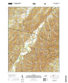
2019 Map of Williamsville
USGS Topo · Published 2019About this map
Patna sits along the winding waters of the Cowpasture River, serving as a quiet point of reference within the southern reaches of the George Washington National Forest. This 2019 survey, compiled from data ranging back to the late 1970s, documents a landscape dominated by the high ridges of the Alleghenies, including Bullpasture Mountain and the prominent Shenandoah Mountain. The map details a complex network of drafts and hollows, such as Slati Lick Draft and Scotchtown Draft, which dictate the rural road patterns and small-scale settlement history of this portion of Bath and Highland Counties. Researchers will find the terrain meticulously contoured, illustrating the dramatic elevation shifts between the river valley and landmarks like Sugarloaf Knob.
Find a feature on this map
1 named feature on this map. Tap any name to fly to it.
Don’t see what you’re looking for? This feature index may not catch every label — zoom into the map to look around manually.
Map Details
Editions of this 2019 Williamsville Map
This is the sole edition of this map. No revisions or reprints were ever made.
Other maps of this area

1894 · Staunton
USGS Topo · 1:125,000

1901 · Monterey
USGS Topo · 1:125,000

1924 · Mc Dowell
USGS Topo · 1:62,500

1941 · Monterey
USGS Topo · 1:62,500

1943 · Craigsville
USGS Topo · 1:62,500

1944 · Monterey
USGS Topo · 1:62,500

1944 · Mc Dowell
USGS Topo · 1:62,500

1945 · Craigsville
USGS Topo · 1:62,500

1946 · Mc Dowell
USGS Topo · 1:62,500

1946 · Williamsville
USGS Topo · 1:62,500