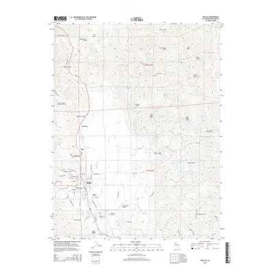
2015 Map of Willits
USGS Topo · Published 2015About this map
Little Lake Valley serves as the central geographic basin for this part of Mendocino County, where the city of Willits is situated at the junction of several canyon systems. The landscape is defined by the drainage patterns of Outlet Cr and its many tributaries, including Baechtel Cr and Broaddus Cr, which flow through the settled areas and into the surrounding timberlands. Smaller residential clusters and historically named locales such as Muir, Fair Oaks, Simerson, and Upp are identified along the primary transit corridors. Aviation infrastructure is represented by the Ells Field-Willits Municipal Airport, located northwest of the main town center. To the east and north, the terrain rises sharply toward Big Darby Peak and Tenney Peak, where the map documents a network of named gulches and ridges like Pepperwood Gulch and Oat Ridge, illustrating the transition from the valley floor to the high coastal range.
Find a feature on this map
90 named features on this map. Tap any name to fly to it.
Don’t see what you’re looking for? This feature index may not catch every label — zoom into the map to look around manually.
Map Details
Editions of this 2015 Willits Map
This is the sole edition of this map. No revisions or reprints were ever made.
Other maps of this area

1922 · Willits
USGS Topo · 1:62,500

1929 · Eden Valley
USGS Topo · 1:62,500

1942 · Willits
USGS Topo · 1:62,500

1943 · Pomo
USGS Topo · 1:62,500

1944 · Willits
USGS Topo · 1:62,500

1951 · Laytonville
USGS Topo · 1:62,500

1952 · Eden Valley
USGS Topo · 1:62,500

1957 · Ukiah
USGS Topo · 1:250,000

1960 · Ukiah
USGS Topo · 1:250,000

1960 · Potter Valley
USGS Topo · 1:62,500