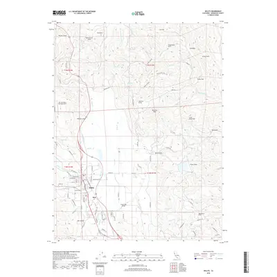
2018 Map of Willits
USGS Topo · Published 2018About this map
Willits serves as the central hub of this northern California landscape, situated within the broad expanse of Little Lake Valley. The town's grid is bisected by the Northwestern Pacific RR, while the surrounding terrain is defined by complex water systems including Outlet Creek, Baechtel Creek, and Haehl Creek. To the south, the map identifies the settlement of Muir and Muir Canyon, illustrating the late-2010s suburban and rural development patterns of Mendocino County.
Find a feature on this map
93 named features on this map. Tap any name to fly to it.
Don’t see what you’re looking for? This feature index may not catch every label — zoom into the map to look around manually.
Map Details
Editions of this 2018 Willits Map
This is the sole edition of this map. No revisions or reprints were ever made.
Other maps of this area

1922 · Willits
USGS Topo · 1:62,500

1929 · Eden Valley
USGS Topo · 1:62,500

1942 · Willits
USGS Topo · 1:62,500

1943 · Pomo
USGS Topo · 1:62,500

1944 · Willits
USGS Topo · 1:62,500

1951 · Laytonville
USGS Topo · 1:62,500

1952 · Eden Valley
USGS Topo · 1:62,500

1957 · Ukiah
USGS Topo · 1:250,000

1960 · Ukiah
USGS Topo · 1:250,000

1960 · Potter Valley
USGS Topo · 1:62,500