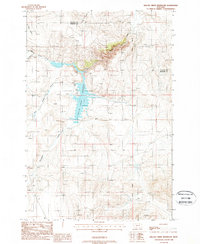
1988 Map of Willow Creek Reservoir
USGS Topo · Published 1988About this map
Willow Creek Reservoir dominates this high-altitude landscape in the late 1980s, where the boundary between Gallatin Co and Madison Co cuts across the northern ridges. This rugged Montana territory is defined by the canyon-carving path of Willow Creek as it enters the reservoir from the northeast, joined by tributaries like Spring Creek and Sand Creek. The map shows a region largely focused on resource management and outdoor access, evidenced by a Boat Ramp, Picnic Area, and the reservoir's Spillway. To the south, the terrain remains less developed, marked by the winding courses of Norwegian Creek and Dry Hollow Creek. Small-scale historical activity is noted at the southern edge of the quadrangle near Prospects, while a lone Storage Bin stands as a rare man-made landmark in the lower reaches of the map.
Find a feature on this map
13 named features on this map. Tap any name to fly to it.
Don’t see what you’re looking for? This feature index may not catch every label — zoom into the map to look around manually.
Map Details
Editions of this 1988 Willow Creek Reservoir Map
This is the sole edition of this map. No revisions or reprints were ever made.
Other maps of this area

1888 · Three Forks
USGS Topo · 1:250,000

1894 · Three Forks
USGS Topo · 1:250,000

1895 · Three Forks
USGS Topo · 1:250,000

1947 · Bozeman
USGS Topo · 1:250,000

1948 · Bozeman
USGS Topo · 1:250,000

1949 · Norris
USGS Topo · 1:62,500

1950 · Three Forks
USGS Topo · 1:62,500

1950 · Jefferson Island
USGS Topo · 1:62,500

1950 · Harrison
USGS Topo · 1:62,500

1951 · Norris
USGS Topo · 1:62,500