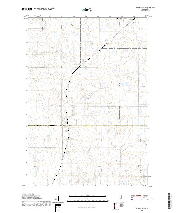
2021 Map of Willow Lake SW
USGS Topo · Published 2021About this map
Coteau des Prairies defines the geography of this portion of the Glacial Lake Agassiz region, characterized by its distinctive prairie pothole landscape and numerous small wetlands. In the northeast corner, the city of Willow Lake sits just south of its namesake water body. The area is a tapestry of section lines and gravel roads like Grant St and Cemetery Rd, reflecting the rigid township and range system that organized this agricultural landscape. Genealogy researchers will find significant sites such as Collins Cem, the St. James Catholic Cem, and the German Presbyterian Cem, each serving as a focal point for the early European immigrant communities that settled the plains. The headwaters of Redstone Cr wind through the southwestern sections, providing natural drainage for the surrounding fields. The boundary between Clark Co and Kingsbury Co runs horizontally through the center of the sheet, marking a significant administrative divide for local historians.
Find a feature on this map
40 named features on this map. Tap any name to fly to it.
Don’t see what you’re looking for? This feature index may not catch every label — zoom into the map to look around manually.
Map Details
Editions of this 2021 Willow Lake SW Map
This is the sole edition of this map. No revisions or reprints were ever made.
Other maps of this area

1899 · De Smet
USGS Topo · 1:125,000

1953 · Watertown
USGS Topo · 1:250,000

1958 · Watertown
USGS Topo · 1:250,000

1971 · Bancroft East
USGS Topo · 1:24,000

1971 · De Smet
USGS Topo · 1:24,000

1971 · Bancroft West
USGS Topo · 1:24,000

1973 · Carpenter SE
USGS Topo · 1:24,000

1973 · Willow Lake
USGS Topo · 1:24,000

1973 · Vienna West
USGS Topo · 1:24,000
1973 · Cherry Lake
USGS Topo · 1:24,000