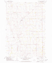
1973 Map of Willow Lake SW
USGS Topo · Published 1978About this map
Burlington Northern rail lines cut through the heart of the prairie landscape, connecting the rural townships of Collins, Spirit Lake, and LeSueur during the 1970s. This agricultural region is defined by a complex network of wetlands and potholes preserved within several tracts of the National Waterfowl Production Area. The landscape reflects a deeply rooted community structure, centered on local landmarks like the Townhall and the spiritual hubs of Spirit Lake Ch and its adjacent Spirit Lake Ch Cem.
Find a feature on this map
15 named features on this map. Tap any name to fly to it.
Don’t see what you’re looking for? This feature index may not catch every label — zoom into the map to look around manually.
Map Details
Editions of this 1973 Willow Lake SW Map
This is the sole edition of this map. No revisions or reprints were ever made.
Other maps of this area

1899 · De Smet
USGS Topo · 1:125,000

1953 · Watertown
USGS Topo · 1:250,000

1958 · Watertown
USGS Topo · 1:250,000

1971 · Bancroft East
USGS Topo · 1:24,000

1971 · De Smet
USGS Topo · 1:24,000

1971 · Bancroft West
USGS Topo · 1:24,000

1973 · Carpenter SE
USGS Topo · 1:24,000

1973 · Willow Lake
USGS Topo · 1:24,000

1973 · Vienna West
USGS Topo · 1:24,000
1973 · Cherry Lake
USGS Topo · 1:24,000