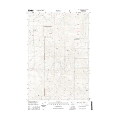
2014 Map of Willow Mountain
USGS Topo · Published 2014About this map
Bitterroot National Forest covers the majority of this terrain, where high peaks and deep drainages define the landscape of Ravalli County. The northern reaches are marked by Schoolhouse Butte and the winding course of Birch Cr, while the central highlands are dominated by the distinct profiles of Dominic Point and Dominic Buttes. Elevation reaches its peak at Willow Mtn and Skalkaho Mtn in the east, overlooking a network of alpine water features including Gleason Lake and Fool Hen Lake. Transport through this backcountry relies on established routes like Coalpit Rd and Blue Sage Trl, which navigate the complex topography carved by Willow Cr and its numerous tributaries. Family-named landmarks such as Charleys Gulch suggest a history of early land use in these mountain drainages.
Find a feature on this map
34 named features on this map. Tap any name to fly to it.
Don’t see what you’re looking for? This feature index may not catch every label — zoom into the map to look around manually.
Map Details
Editions of this 2014 Willow Mountain Map
This is the sole edition of this map. No revisions or reprints were ever made.
Other maps of this area

1901 · Hamilton
USGS Topo · 1:125,000

1909 · Sapphire
USGS Topo · 1:125,000

1947 · Butte
USGS Topo · 1:250,000

1956 · Hamilton
USGS Topo · 1:250,000

1958 · Butte
USGS Topo · 1:250,000

1959 · Hamilton
USGS Topo · 1:250,000

1960 · Butte
USGS Topo · 1:250,000

1960 · Hamilton
USGS Topo · 1:250,000

1962 · Butte
USGS Topo · 1:250,000

1964 · Hamilton
USGS Topo · 1:250,000