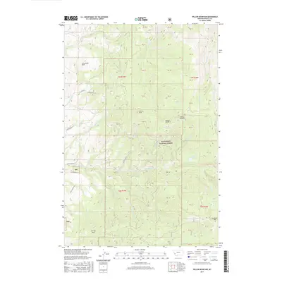
2017 Map of Willow Mountain
USGS Topo · Published 2017About this map
Bitterroot National Forest dominates this section of the Sapphire Mountains, where the terrain is defined by a dense network of high-altitude drainages and prominent peaks. The landscape centers on the massifs of Willow Mountain and Skalkaho Mtn, with local landmarks like Dominic Buttes and Schoolhouse Butte providing distinct vertical relief. For genealogists and local historians, the map preserves names associated with early land use and topography, such as Charleys Gulch and Balsam Spring. A web of watercourses, including Birch Creek, Gold Creek, and Flat Rock Creek, carves through the forest, feeding into small alpine basins like Gleason Lake and Fool Hen Lake. Access into these higher elevations is charted via the Sapphire Ranch Trail and Willow Creek Road, reflecting the area's continued use for resource management and recreation within the Bitterroot National Forest boundaries.
Find a feature on this map
46 named features on this map. Tap any name to fly to it.
Don’t see what you’re looking for? This feature index may not catch every label — zoom into the map to look around manually.
Map Details
Editions of this 2017 Willow Mountain Map
This is the sole edition of this map. No revisions or reprints were ever made.
Other maps of this area

1901 · Hamilton
USGS Topo · 1:125,000

1909 · Sapphire
USGS Topo · 1:125,000

1947 · Butte
USGS Topo · 1:250,000

1956 · Hamilton
USGS Topo · 1:250,000

1958 · Butte
USGS Topo · 1:250,000

1959 · Hamilton
USGS Topo · 1:250,000

1960 · Butte
USGS Topo · 1:250,000

1960 · Hamilton
USGS Topo · 1:250,000

1962 · Butte
USGS Topo · 1:250,000

1964 · Hamilton
USGS Topo · 1:250,000