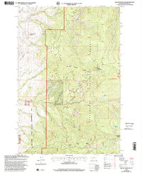
1998 Map of Willow Mountain
USGS Topo · Published 2002About this map
Willow Mountain Lookout stands as a prominent high-elevation vantage point overlooking the extensive drainages of the Bitterroot National Forest. This 1998 revision, based on surveys dating back to the mid-1960s, documents a landscape shaped by public land management and outdoor recreation. The map details the Palisade Mountain National Recreation Trail and various water sources such as Balsam Spring and Fool Hen Lake, essential for both wildlife and high-country travel.
Find a feature on this map
32 named features on this map. Tap any name to fly to it.
Don’t see what you’re looking for? This feature index may not catch every label — zoom into the map to look around manually.
Map Details
Editions of this 1998 Willow Mountain Map
This is the sole edition of this map. No revisions or reprints were ever made.
Other maps of this area

1901 · Hamilton
USGS Topo · 1:125,000

1909 · Sapphire
USGS Topo · 1:125,000

1947 · Butte
USGS Topo · 1:250,000

1956 · Hamilton
USGS Topo · 1:250,000

1958 · Butte
USGS Topo · 1:250,000

1959 · Hamilton
USGS Topo · 1:250,000

1960 · Butte
USGS Topo · 1:250,000

1960 · Hamilton
USGS Topo · 1:250,000

1962 · Butte
USGS Topo · 1:250,000

1964 · Hamilton
USGS Topo · 1:250,000