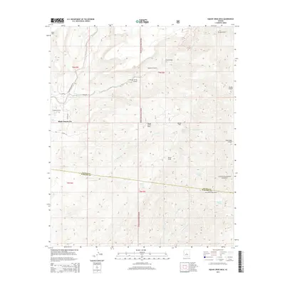
2014 Map of Willow Spring Canyon
USGS Topo · Published 2014About this map
Black Canyon City sits at the southwestern edge of this landscape, positioned where the Agua Fria River meets the foothills of the New River Mountains. This 2014 survey documents a rugged portion of the Tonto National Forest that straddles the boundary between Yavapai and Maricopa Counties. The terrain is defined by high plateaus like Squaw Creek Mesa and Black Mesa, cut by a complex drainage system including Squaw Creek and the long reach of Willow Spring Canyon. The presence of several cattle-ranching and water-management features, such as Woody Tank and Brushy Tanks, points to the area's continued use for grazing. Local history and geography are preserved in named landmarks like Boteler Peak and Shorty Smith Spring, while the winding Old Perry Buchanan Rd provides a trace of historical movement through these canyons.
Find a feature on this map
34 named features on this map. Tap any name to fly to it.
Don’t see what you’re looking for? This feature index may not catch every label — zoom into the map to look around manually.
Map Details
Editions of this 2014 Willow Spring Canyon Map
This is the sole edition of this map. No revisions or reprints were ever made.
Other maps of this area

1887 · Verde
USGS Topo · 1:250,000

1887 · Prescott
USGS Topo · 1:250,000

1892 · Verde
USGS Topo · 1:250,000

1892 · Prescott
USGS Topo · 1:250,000

1903 · Bradshaw Mountains
USGS Topo · 1:125,000

1929 · Turret Peak
USGS Topo · 1:125,000

1930 · Cave Creek
USGS Topo · 1:125,000

1933 · Turret Peak
USGS Topo · 1:125,000

1939 · Cave Creek
USGS Topo · 1:125,000

1947 · Bumblebee
USGS Topo · 1:62,500