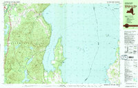
1980 Map of Willsboro Bay
USGS Topo · Published 1981About this map
Adirondack Park dominates the western half of this study, where the peaks of Trembleau Mtn and Rattlesnake Mtn overlook the deep waters of Lake Champlain. The landscape is a mix of dense forest and recreational outposts, including Camp Lincoln and Camp Pokamoonshine near the southern edge. Along the coast, the narrow peninsula of Willsboro Point extends into the lake, sheltering Willsboro Bay from the main body of water and the distant shoreline of Burlington on the Vermont side.
Find a feature on this map
77 named features on this map. Tap any name to fly to it.
Don’t see what you’re looking for? This feature index may not catch every label — zoom into the map to look around manually.
Map Details
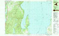
Editions of this 1980 Willsboro Bay Map
2 editions found
Other maps of this area

1894 · Plattsburg
USGS Topo · 1:62,500

1895 · Willsboro
USGS Topo · 1:62,500

1895 · Ausable
USGS Topo · 1:62,500

1903 · Ausable
USGS Topo · 1:62,500

1906 · Plattsburg
USGS Topo · 1:62,500

1906 · Burlington
USGS Topo · 1:62,500

1913 · Dannemora
USGS Topo · 1:62,500

1913 · Milton
USGS Topo · 1:48,000

1915 · Milton
USGS Topo · 1:62,500

1919 · Burlington
USGS Topo · 1:62,500