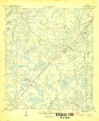
1946 Map of Wilma
USGS Topo · Published 1946About this map
Apalachicola National Forest dominates this mid-1940s landscape, where the Apalachicola Northern railroad cuts a straight line through the wet pine flatwoods and cypress strands of Liberty County. Small interior settlements such as Wilma, Vilas, and Central City are positioned along this vital rail corridor, which served as the primary connection through the dense vegetation of Whitehead Swamp and Thomas Bay.
Find a feature on this map
25 named features on this map. Tap any name to fly to it.
Don’t see what you’re looking for? This feature index may not catch every label — zoom into the map to look around manually.
Map Details
Editions of this 1946 Wilma Map
3 editions found
Other maps of this area

1944 · Queens Bay
USGS Topo · 1:24,000

1945 · Kennedy Creek
USGS Topo · 1:31,680

1945 · Estiffanulga
USGS Topo · 1:31,680

1945 · Orange
USGS Topo · 1:31,680

1945 · Woods
USGS Topo · 1:31,680

1945 · Telogia
USGS Topo · 1:24,000

1946 · Queens Bay
USGS Topo · 1:31,680

1946 · Sumatra
USGS Topo · 1:31,680

1946 · Telogia
USGS Topo · 1:31,680

1946 · Owens Bridge
USGS Topo · 1:31,680