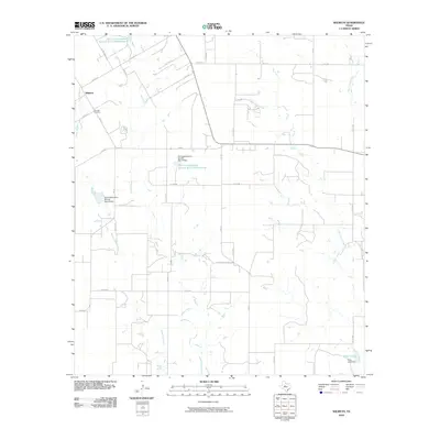
2010 Map of Wilmeth
USGS Topo · Published 2010About this map
Wilmeth serves as the central settlement in this rural Runnels County landscape, which is defined by a sophisticated system of water management and agricultural infrastructure. The topography is shaped by the drainages of Valley Creek, Mustang Branch, and both Little Coyote Creek and Big Coyote Creek. These waterways are punctuated by numerous federally managed features, including the Soil Conservation Service Site 18 Reservoir, Soil Conservation Service Site 19 Reservoir, and the Soil Conservation Service Site 20 Dam, illustrating the mid-century transition toward intensive soil conservation practices in West Texas. For those researching local history, the Wilmeth Cemetery sits just southwest of the primary crossroads, while the presence of Allen Lake and its associated Allen Lake Dam in the southeast corner provides additional landmarks for tracing property lines and historical land use. The map's grid of county roads, such as Co RD 381 and FM 384, reveals the enduring spatial organization of this ranching and farming community.
Find a feature on this map
32 named features on this map. Tap any name to fly to it.
Don’t see what you’re looking for? This feature index may not catch every label — zoom into the map to look around manually.
Map Details
Editions of this 2010 Wilmeth Map
This is the sole edition of this map. No revisions or reprints were ever made.
Other maps of this area

1890 · Abilene
USGS Topo · 1:125,000

1891 · Hayrick
USGS Topo · 1:125,000

1892 · Abilene
USGS Topo · 1:125,000

1892 · Ballinger
USGS Topo · 1:125,000

1893 · Sweetwater
USGS Topo · 1:125,000

1894 · Hayrick
USGS Topo · 1:125,000

1921 · Hatchel
USGS Topo · 1:31,680

1921 · Maverick
USGS Topo · 1:31,680

1921 · Quarry Creek
USGS Topo · 1:31,680

1954 · Brownwood
USGS Topo · 1:250,000