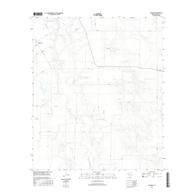
2016 Map of Wilmeth
USGS Topo · Published 2016About this map
The small settlement of Wilmeth sits at the intersection of several rural routes in northwestern Runnels County. This 2016 survey highlights a landscape defined by ranching and water management, with numerous small reservoirs and drainage systems networked across the terrain. Notable among these are the Soil Conservation Service Site 18 Reservoir and Soil Conservation Service Site 19 Reservoir, which support the local watershed near Valley Creek. For genealogists and local historians, the Wilmeth Cem provides a primary point of reference for the families that settled this portion of Texas. The map also traces the winding paths of seasonal waterways such as Mustang Br and Little Coyote Cr, illustrating the vital role of drainage in this agrarian environment.
Find a feature on this map
36 named features on this map. Tap any name to fly to it.
Don’t see what you’re looking for? This feature index may not catch every label — zoom into the map to look around manually.
Map Details
Editions of this 2016 Wilmeth Map
This is the sole edition of this map. No revisions or reprints were ever made.
Other maps of this area

1890 · Abilene
USGS Topo · 1:125,000

1891 · Hayrick
USGS Topo · 1:125,000

1892 · Abilene
USGS Topo · 1:125,000

1892 · Ballinger
USGS Topo · 1:125,000

1893 · Sweetwater
USGS Topo · 1:125,000

1894 · Hayrick
USGS Topo · 1:125,000

1921 · Hatchel
USGS Topo · 1:31,680

1921 · Maverick
USGS Topo · 1:31,680

1921 · Quarry Creek
USGS Topo · 1:31,680

1954 · Brownwood
USGS Topo · 1:250,000