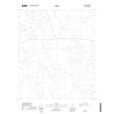
2019 Map of Wilmeth
USGS Topo · Published 2019About this map
Wilmeth and its surrounding agricultural lands are documented here in 2019, showing the persistent rural layout of northern Runnels County. The small community is anchored by the Wilmeth Cem, a vital point of reference for genealogists tracing local families. The landscape is defined by the drainage systems of Mustang Br, Valley Cr, and Little Coyote Cr, which feed into modern water management infrastructure including the Soil Conservation Service Site 18 Reservoir. A network of county roads, such as Co RD 324 and Co RD 386, crisscrosses the terrain, linking isolated farmsteads and agricultural operations to state routes like 153. This modern survey reflects the enduring character of a West Texas ranching and farming district where water resources and land ownership patterns have remained consistent over decades.
Find a feature on this map
34 named features on this map. Tap any name to fly to it.
Don’t see what you’re looking for? This feature index may not catch every label — zoom into the map to look around manually.
Map Details
Editions of this 2019 Wilmeth Map
This is the sole edition of this map. No revisions or reprints were ever made.
Other maps of this area

1890 · Abilene
USGS Topo · 1:125,000

1891 · Hayrick
USGS Topo · 1:125,000

1892 · Abilene
USGS Topo · 1:125,000

1892 · Ballinger
USGS Topo · 1:125,000

1893 · Sweetwater
USGS Topo · 1:125,000

1894 · Hayrick
USGS Topo · 1:125,000

1921 · Hatchel
USGS Topo · 1:31,680

1921 · Maverick
USGS Topo · 1:31,680

1921 · Quarry Creek
USGS Topo · 1:31,680

1954 · Brownwood
USGS Topo · 1:250,000