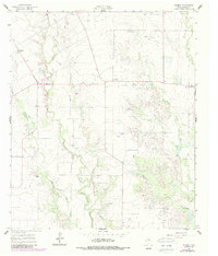
1961 Map of Wilmeth
USGS Topo · Published 1987About this map
Valley Creek winds through the western portion of this Runnels County landscape, which was primarily shaped by cattle ranching and early petroleum exploration during the mid-20th century. The settlement of Wilmeth serves as a local focal point, supported by nearby community landmarks like the Wilmeth Cem and the Old Norton Ch. Small clusters of homes and outbuildings are scattered along the drainage basins of Mustang Branch and Little Coyote Creek, reflecting the rural Texas settlement patterns of the era.
Find a feature on this map
13 named features on this map. Tap any name to fly to it.
Don’t see what you’re looking for? This feature index may not catch every label — zoom into the map to look around manually.
Map Details
Editions of this 1961 Wilmeth Map
This is the sole edition of this map. No revisions or reprints were ever made.
Other maps of this area

1890 · Abilene
USGS Topo · 1:125,000

1891 · Hayrick
USGS Topo · 1:125,000

1892 · Abilene
USGS Topo · 1:125,000

1892 · Ballinger
USGS Topo · 1:125,000

1893 · Sweetwater
USGS Topo · 1:125,000

1894 · Hayrick
USGS Topo · 1:125,000

1921 · Hatchel
USGS Topo · 1:31,680

1921 · Maverick
USGS Topo · 1:31,680

1921 · Quarry Creek
USGS Topo · 1:31,680

1954 · Brownwood
USGS Topo · 1:250,000