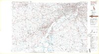
1984 Map of Wilmington
USGS Topo · Published 1986About this map
The Delaware River serves as the central artery for this complex mid-1980s intersection of four states, documenting the dense industrial and suburban growth surrounding Wilmington and Philadelphia. The map captures a moment when the regional transit network was fully mature, showing the intricate corridors of Amtrak and Conrail lines alongside the heavy traffic of I-95 and I-295. This convergence of rail and road illustrates the area's role as a critical East Coast transportation hub.
Find a feature on this map
250 named features on this map. Tap any name to fly to it.
Don’t see what you’re looking for? This feature index may not catch every label — zoom into the map to look around manually.
Map Details
Editions of this 1984 Wilmington Map
2 editions found
Other maps of this area

1888 · Mount Holly
USGS Topo · 1:62,500

1890 · Hammonton
USGS Topo · 1:62,500

1890 · Salem
USGS Topo · 1:62,500

1890 · Tuckahoe
USGS Topo · 1:62,500

1890 · Bay Side
USGS Topo · 1:62,500

1890 · Bridgeton
USGS Topo · 1:62,500

1890 · Burlington
USGS Topo · 1:62,500

1890 · Glassboro
USGS Topo · 1:62,500

1891 · Philadelphia
USGS Topo · 1:62,500

1893 · Germantown
USGS Topo · 1:62,500