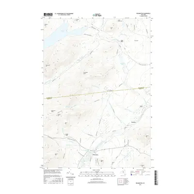
2016 Map of Wilmington
USGS Topo · Published 2016About this map
Wilmington serves as the primary hub of this mountain landscape, situated at the base of the Wilmington Range and along the West Branch Ausable River. The area is characterized by high-elevation peaks such as Catamount Mtn, Morgan Mtn, and Marble Mtn, many of which fall within the Adirondack Park Preserve. Local history and recreation are reflected in features like the Cooper Kiln Trail and the unique settlement of North Pole. North of the river, small historic clusters such as Haselton and East Kilns are mapped alongside family landmarks like Malbone Cem. The terrain is deeply carved by drainage systems including Big Brown Brook and Pettigrew Brook, with Taylor Pond dominating the northwestern corner. The map captures the specialized mountain character of the area, noting the Catalano Airfield and the steep descent of Poorman's Downhill.
Find a feature on this map
68 named features on this map. Tap any name to fly to it.
Don’t see what you’re looking for? This feature index may not catch every label — zoom into the map to look around manually.
Map Details
Editions of this 2016 Wilmington Map
This is the sole edition of this map. No revisions or reprints were ever made.
Other maps of this area

1895 · Ausable
USGS Topo · 1:62,500

1896 · Lake Placid
USGS Topo · 1:62,500

1898 · Lake Placid
USGS Topo · 1:62,500

1903 · Ausable
USGS Topo · 1:62,500

1911 · Lyon Mountain
USGS Topo · 1:62,500

1913 · Dannemora
USGS Topo · 1:62,500

1913 · Lyon Mountain
USGS Topo · 1:62,500

1931 · Lyon Mountain
USGS Topo · 1:62,500

1950 · Lake Champlain
USGS Topo · 1:250,000

1953 · Lake Placid
USGS Topo · 1:62,500