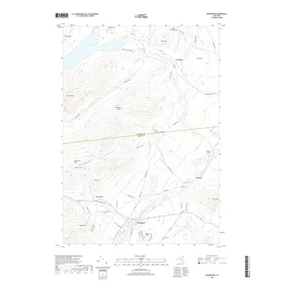
2019 Map of Wilmington
USGS Topo · Published 2019About this map
The West Branch Ausable River flows through the heart of this region, shaping the development of Wilmington and the surrounding mountain valley. This 2019 survey documents a landscape defined by significant peaks, including the Wilmington Range and Marble Mountain, which hem in the settlements and historic trail networks. To the north, the waters of Taylor Pond and the East Kilns area reflect the region's historical industrial footprint, while the Haselton settlement and its nearby Haselton Cem provide localized points of genealogical interest. The map also captures modern recreational and transport features, from the quirky tourist destination of North Pole to the Catalano Airfield, set against the backdrop of the extensive Adirondack Park Preserve. The terrain is crisscrossed by established routes like the Cooper Kill Trail, illustrating how the geography dictates movement through these high-altitude corridors.
Find a feature on this map
66 named features on this map. Tap any name to fly to it.
Don’t see what you’re looking for? This feature index may not catch every label — zoom into the map to look around manually.
Map Details
Editions of this 2019 Wilmington Map
This is the sole edition of this map. No revisions or reprints were ever made.
Other maps of this area

1895 · Ausable
USGS Topo · 1:62,500

1896 · Lake Placid
USGS Topo · 1:62,500

1898 · Lake Placid
USGS Topo · 1:62,500

1903 · Ausable
USGS Topo · 1:62,500

1911 · Lyon Mountain
USGS Topo · 1:62,500

1913 · Dannemora
USGS Topo · 1:62,500

1913 · Lyon Mountain
USGS Topo · 1:62,500

1931 · Lyon Mountain
USGS Topo · 1:62,500

1950 · Lake Champlain
USGS Topo · 1:250,000

1953 · Lake Placid
USGS Topo · 1:62,500