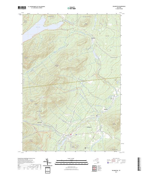
2023 Map of Wilmington
USGS Topo · Published 2023About this map
The West Branch Ausable River winds through this section of the Adirondacks, anchoring the valley where the town of Wilmington and the smaller settlement of Haselton are located. This modern survey reflects a landscape shaped by both recreation and mountain geography, with the Adirondack Park Preserve encompassing much of the high ground. To the north, Taylor Pond and Taylor Pond Outlet sit below Douglas Mountain, while the massive Wilmington Range and Stephenson Range dominate the central and western terrain. Local history is marked by small crossroads and legacy sites like East Kilns and the North Pole community. For those tracing local families, the map identifies the Haselton Cem and Malbone Cem. Numerous hiking and utility paths, including the Catamount Trl and Cooper Kill Trl, crisscross the ridges, showing the extensive trail network supporting the area's contemporary role as an outdoor destination.
Find a feature on this map
72 named features on this map. Tap any name to fly to it.
Don’t see what you’re looking for? This feature index may not catch every label — zoom into the map to look around manually.
Map Details
Editions of this 2023 Wilmington Map
This is the sole edition of this map. No revisions or reprints were ever made.
Other maps of this area

1895 · Ausable
USGS Topo · 1:62,500

1896 · Lake Placid
USGS Topo · 1:62,500

1898 · Lake Placid
USGS Topo · 1:62,500

1903 · Ausable
USGS Topo · 1:62,500

1911 · Lyon Mountain
USGS Topo · 1:62,500

1913 · Dannemora
USGS Topo · 1:62,500

1913 · Lyon Mountain
USGS Topo · 1:62,500

1931 · Lyon Mountain
USGS Topo · 1:62,500

1950 · Lake Champlain
USGS Topo · 1:250,000

1953 · Lake Placid
USGS Topo · 1:62,500