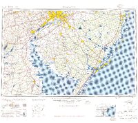
1957 Map of Wilmington
USGS Topo · Published 1957About this map
Philadelphia and Wilmington anchor this mid-century regional overview, documenting the post-war industrial and suburban expansion across the Delaware Valley. The transport network of the mid-1950s is clearly visible, featuring the recently constructed New Jersey Turnpike and the Garden State Parkway facilitating movement toward the shore. In the southern interior, the map shows the transition from the dense urban corridors of Camden and Chester to the agricultural and glass-manufacturing landscapes around Vineland and Millville. Along the coast, the barrier island communities from Atlantic City south to Wildwood are mapped in detail, showing their relationship to the Atlantic Ocean and protected marshes. Federal and military presence is prominent, with the Fort Dix Military Reservation and the Dover Air Force Base established as major regional landmarks during this era of defense-driven growth.
Find a feature on this map
163 named features on this map. Tap any name to fly to it.
Don’t see what you’re looking for? This feature index may not catch every label — zoom into the map to look around manually.
Map Details
Editions of this 1957 Wilmington Map
2 editions found
Historical Maps of Philadelphia Through Time
10 maps found

1904 Wilmington
New Castle County, DE
1906 Wilmington
New Castle County, DE

1919 Wilmington
New Castle County, DE

1946 Wilmington
New Castle County, DE

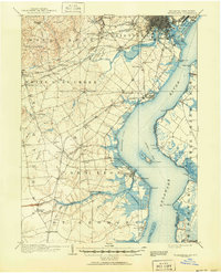
1955 Wilmington
New Castle County, DE

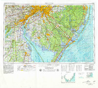
1957 Wilmington
New Castle County, DE

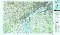
1959 Wilmington
New Castle County, DE
1966 Wilmington
New Castle County, DE

1972 Wilmington
New Castle County, DE
1984 Wilmington
New Castle County, DE