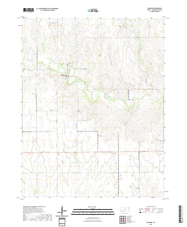
2022 Map of Wilmore
USGS Topo · Published 2022About this map
Wilmore serves as the primary hub in this corner of Comanche County, concentrated around the intersection of Main St and Taft St. The town's local history is anchored by the Wilmore Cem to the north, overlooking the drainage of Mule Cr. The surrounding landscape is defined by a dense network of creek beds and canyons, where the terrain breaks into features like Snooks Hollow and Baker Canyon. A grid of rural routes, including Wilmore Rd and Sun City Rd, connects the scattered farmsteads across the township lines. The hydrology is particularly intricate here, with Nescatunga Cr and its tributary, E Br Nescatunga Cr, carving through the southern sections of the quadrangle, illustrating the drainage patterns that have shaped the agricultural layout of the region.
Find a feature on this map
32 named features on this map. Tap any name to fly to it.
Don’t see what you’re looking for? This feature index may not catch every label — zoom into the map to look around manually.
Map Details
Editions of this 2022 Wilmore Map
This is the sole edition of this map. No revisions or reprints were ever made.
Other maps of this area

1892 · Coldwater
USGS Topo · 1:125,000

1955 · Pratt
USGS Topo · 1:250,000

1959 · Pratt
USGS Topo · 1:250,000

1968 · Wilmore SE
USGS Topo · 1:24,000

1968 · Belvidere
USGS Topo · 1:24,000

1979 · Coldwater
USGS Topo · 1:24,000

1979 · Protection NE
USGS Topo · 1:24,000
1980 · Nescatunga Creek North
USGS Topo · 1:24,000
1980 · Wilmore
USGS Topo · 1:24,000
1980 · Coldwater NE
USGS Topo · 1:24,000