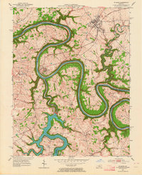
1952 Map of Wilmore
USGS Topo · Published 1964About this map
The winding Kentucky River carves deep meanders through the central Bluegrass region, defining the borders of Jessamine, Mercer, and Garrard counties. At the heart of this landscape, Wilmore serves as a primary settlement along the Southern railroad line, which crosses the river at the engineering landmark of High Bridge. To the south, the Dix River is transformed by the Dix Dam, creating the sprawling waters of Herrington Lake.
Find a feature on this map
48 named features on this map. Tap any name to fly to it.
Don’t see what you’re looking for? This feature index may not catch every label — zoom into the map to look around manually.
Map Details
Editions of this 1952 Wilmore Map
3 editions found
Other maps of this area

1905 · Harrodsburg
USGS Topo · 1:125,000

1950 · Bryantsville
USGS Topo · 1:24,000

1952 · Keene
USGS Topo · 1:24,000

1952 · Little Hickman
USGS Topo · 1:24,000

1952 · Nicholasville
USGS Topo · 1:24,000

1952 · Buckeye
USGS Topo · 1:24,000

1952 · Danville
USGS Topo · 1:24,000

1952 · Harrodsburg
USGS Topo · 1:24,000

1952 · Bryantsville
USGS Topo · 1:24,000

1952 · Salvisa
USGS Topo · 1:24,000