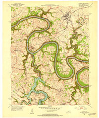
1952 Map of Wilmore
USGS Topo · Published 1953About this map
Wilmore serves as a prominent focal point on this mid-century survey, situated within a landscape dominated by the dramatic meanders of the Kentucky River. The map illustrates a period of established settlement where the community of Shakertown stands as a distinct landmark west of the river's deep bends. The topography is defined by the sharp vertical relief along the riverbanks, contrasted by the relatively level uplands where most habitation and infrastructure are concentrated. The detailed rendering of property footprints and local roads near the town center provides an important perspective on the layout of this Jessamine County region before decades of modern expansion. The surveyor's notes on bench marks and elevation data emphasize the technical precision required to map this complex riverine terrain.
Find a feature on this map
2 named features on this map. Tap any name to fly to it.
Don’t see what you’re looking for? This feature index may not catch every label — zoom into the map to look around manually.
Map Details
Editions of this 1952 Wilmore Map
3 editions found
Other maps of this area

1905 · Harrodsburg
USGS Topo · 1:125,000

1950 · Bryantsville
USGS Topo · 1:24,000

1952 · Keene
USGS Topo · 1:24,000

1952 · Little Hickman
USGS Topo · 1:24,000

1952 · Nicholasville
USGS Topo · 1:24,000

1952 · Buckeye
USGS Topo · 1:24,000

1952 · Danville
USGS Topo · 1:24,000

1952 · Harrodsburg
USGS Topo · 1:24,000

1952 · Bryantsville
USGS Topo · 1:24,000

1952 · Salvisa
USGS Topo · 1:24,000