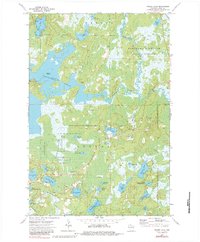
1973 Map of Wilson Lake
USGS Topo · Published 1984About this map
The vast Turtle-Flambeau Flowage dominates this northern Wisconsin landscape, where the Manitowish River and Bear River converge. This 1973 survey reflects a region deeply shaped by water management and conservation, with large tracts of land dedicated to the Northern Highland State Forest and the Boot Lake State Wildlife Area. Distinctive landmarks like Bonies Mound rise above the wetlands, while numerous small lakes—including Lehto Lake, Bearskull Lake, and Mirror Lake—dot the timbered terrain. The presence of Murrays Landing and several boat ramps suggests the area's established role as a destination for outdoor recreation. In the southern portion of the quadrangle, Springstead Creek feeds into Upper Springstead Lake, illustrating the complex glacial drainage patterns that define Iron County's lake country during this era.
Find a feature on this map
39 named features on this map. Tap any name to fly to it.
Don’t see what you’re looking for? This feature index may not catch every label — zoom into the map to look around manually.
Map Details
Editions of this 1973 Wilson Lake Map
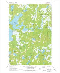
2 editions found
Other maps of this area

1938 · Lac Du Flambeau
USGS Topo · 1:48,000

1939 · Lac Du Flambeau
USGS Topo · 1:48,000

1939 · Winchester
USGS Topo · 1:48,000

1940 · Mercer
USGS Topo · 1:48,000

1941 · Pike Lake
USGS Topo · 1:48,000

1942 · Pike Lake
USGS Topo · 1:48,000

1945 · Mercer
USGS Topo · 1:48,000

1946 · Winchester
USGS Topo · 1:48,000

1946 · Lac Du Flambeau
USGS Topo · 1:48,000

1947 · Mercer
USGS Topo · 1:48,000