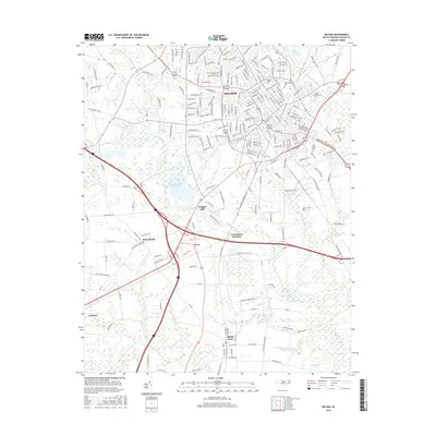
2016 Map of Wilson
USGS Topo · Published 2016About this map
Wilson serves as the focal point of this coastal plain landscape, where the urban grid meets a network of slow-moving waterways and reservoirs. The city’s identity is shaped by educational institutions like Barton College and Wilson Community College, alongside established local landmarks such as Maplewood Cemetery. Moving south from the city center, the terrain transitions into a mosaic of wetlands and small rural clusters. Contentnea Creek winds through the region, feeding the Wiggins Mill Reservoir and defining the area near Wiggins Mill. This 2016 survey captures the established connectivity between outlying communities like Lucama and Black Creek, following the rail and road corridors that have historically linked these agricultural and trade hubs. The presence of Toisnot Swamp and Hominy Swamp highlights the natural drainage patterns that have long influenced the development and placement of North Carolina's eastern settlements.
Find a feature on this map
194 named features on this map. Tap any name to fly to it.
Don’t see what you’re looking for? This feature index may not catch every label — zoom into the map to look around manually.
Map Details
Editions of this 2016 Wilson Map
This is the sole edition of this map. No revisions or reprints were ever made.
Other maps of this area

1902 · Kenly
USGS Topo · 1:62,500

1902 · Rocky Mount
USGS Topo · 1:62,500

1902 · Spring Hope
USGS Topo · 1:62,500

1903 · Kenly
USGS Topo · 1:62,500

1904 · Rocky Mount
USGS Topo · 1:62,500

1904 · Springhope
USGS Topo · 1:62,500

1904 · Wilson
USGS Topo · 1:62,500

1953 · Rocky Mount
USGS Topo · 1:250,000

1953 · Raleigh
USGS Topo · 1:250,000

1954 · Rocky Mount
USGS Topo · 1:250,000