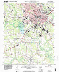
1998 Map of Wilson
USGS Topo · Published 2001About this map
Wilson serves as the focal point of this late 20th-century survey, showcasing its growth as an educational and industrial hub in eastern North Carolina. The city layout includes notable institutions such as Barton College and the Eastern NC Sch for Deaf, alongside a dense network of local schools and municipal infrastructure like the Wilson County Hospital. Significant infrastructure projects define the outskirts, notably the Wiggins Mill Reservoir and the Sewage Disposal facilities south of town.
Find a feature on this map
76 named features on this map. Tap any name to fly to it.
Don’t see what you’re looking for? This feature index may not catch every label — zoom into the map to look around manually.
Map Details
Editions of this 1998 Wilson Map
This is the sole edition of this map. No revisions or reprints were ever made.
Other maps of this area

1902 · Kenly
USGS Topo · 1:62,500

1902 · Rocky Mount
USGS Topo · 1:62,500

1902 · Spring Hope
USGS Topo · 1:62,500

1903 · Kenly
USGS Topo · 1:62,500

1904 · Rocky Mount
USGS Topo · 1:62,500

1904 · Springhope
USGS Topo · 1:62,500

1904 · Wilson
USGS Topo · 1:62,500

1953 · Rocky Mount
USGS Topo · 1:250,000

1953 · Raleigh
USGS Topo · 1:250,000

1954 · Rocky Mount
USGS Topo · 1:250,000