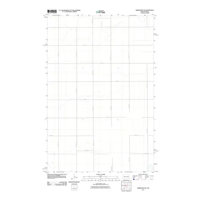
2011 Map of Wimbledon NE
USGS Topo · Published 2011About this map
Uxbridge Township in Barnes County is defined by its precise agrarian geometry in the early twenty-first century. The landscape is dominated by the North Dakota section-line road grid, where north-south arteries like 101st Ave SE and 106th Ave SE intersect with a series of east-west corridors from 13th St SE down to 19th St SE. This survey illustrates the high-plains drainage patterns that subtly disrupt the rectilinear plan, with small wetlands and seasonal watercourses meandering across the prairie between 102nd Ave SE and 104th Ave SE. While devoid of major settlements, the map provides a look at the rural infrastructure and land divisions that have sustained this region's agricultural character for generations.
Find a feature on this map
13 named features on this map. Tap any name to fly to it.
Don’t see what you’re looking for? This feature index may not catch every label — zoom into the map to look around manually.
Map Details
Editions of this 2011 Wimbledon NE Map
This is the sole edition of this map. No revisions or reprints were ever made.
Other maps of this area

1952 · New Rockford
USGS Topo · 1:250,000

1956 · New Rockford
USGS Topo · 1:250,000

1961 · Leal
USGS Topo · 1:24,000

1961 · Revere
USGS Topo · 1:24,000

1961 · Wimbledon
USGS Topo · 1:24,000

1961 · Hannaford
USGS Topo · 1:24,000

1961 · Wimbledon NE
USGS Topo · 1:24,000

1961 · Rogers
USGS Topo · 1:24,000
1961 · Sutton SW
USGS Topo · 1:24,000

1961 · Dazey
USGS Topo · 1:24,000