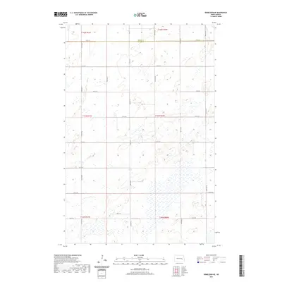
2020 Map of Wimbledon NE
USGS Topo · Published 2020About this map
The county line between Griggs Co Barnes Co defines the northern edge of this high-plains landscape, where the Jeffersonian grid of the Public Land Survey System is etched into the terrain. Situated in the Drift Prairie region of North Dakota, the map reveals a complex mosaic of prairie potholes and seasonal wetlands that dominate the southern sections. This natural drainage pattern suggests a land shaped by glacial recession, where small depressions hold water across the townships of T143N and T142N.
Find a feature on this map
21 named features on this map. Tap any name to fly to it.
Don’t see what you’re looking for? This feature index may not catch every label — zoom into the map to look around manually.
Map Details
Editions of this 2020 Wimbledon NE Map
This is the sole edition of this map. No revisions or reprints were ever made.
Other maps of this area

1952 · New Rockford
USGS Topo · 1:250,000

1956 · New Rockford
USGS Topo · 1:250,000

1961 · Leal
USGS Topo · 1:24,000

1961 · Revere
USGS Topo · 1:24,000

1961 · Wimbledon
USGS Topo · 1:24,000

1961 · Hannaford
USGS Topo · 1:24,000

1961 · Wimbledon NE
USGS Topo · 1:24,000

1961 · Rogers
USGS Topo · 1:24,000
1961 · Sutton SW
USGS Topo · 1:24,000

1961 · Dazey
USGS Topo · 1:24,000